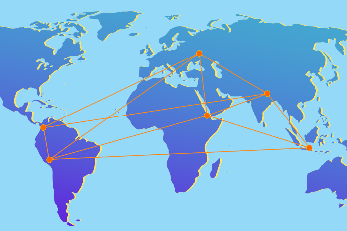
In February 2016, Secondary Cities project kicked off in Kharkiv, Ukraine. It is carried out by Humanitarian Information Unit of US State Department in collaboration with American Association of Geographers and Colorado State University. Secondary Cities project aims to “build partnerships to create geospatial capacity, enhance understanding through data and mapping and enable science-based decision making.”. Currently the project is carried out in six cities in various countries of the world (soon to be more). In Ukraine, the practical part of Secondary cities consisted of two training courses that took part in universities of Kharkiv in May and September 2016.
During the second training, the editorial team of our blog had a chance to talk to representatives of Secondary Cities project on several occasions. We asked them, why Kharkiv was chosen as a secondary city (without context this adjective may seem offensive for a city with a million plus population:)), how participants were chosen and what awaits them in the future.
We met Candida Mannozzi and professor Melinda Laituri during a coffee break and were impressed by their sincerity and energetic attitude. Here is what we talked about.

Candida Mannozzi and Melinda Laituri
Candida Mannozzi:
Candida Mannozzi from the American Association of geographers. I am the lead implementer of the Secondary cities Kharkiv project, this one of six.
Melinda Laituri:
I’m Melinda Laituri, the principal investigator with the Secondary cities project. And also a professor at Colorado State University.
Ganna Novgoroda:
It says on the Secondary cities website, that mapping is essential in building urban resilience, why is that?
ML:
What we map in the city is dependent upon what’s important for that city. So that’s quite essential that we work with local people to understand what the issues are. And what needs to be mapped for the city. Many times there’s information that is lacking. And so a city is not completely mapped in terms of the extent of its roads, or maybe what its water supply is, or where the electrical services are provided, sanitation things. Maybe it’s a little bit different here, in Ukraine, where people have access to fundamental resources. But in many cities throughout the world people do not have access to electricity or water or sanitation and so we map who has those things and who doesn’t. It tells us how to plan for the future.
AN:
There are six cities in the secondary cities project at present. Why was Kharkiv chosen?
ML:
There’s a couple of reasons why. This is a strategic place in the world. You have issues that are associated with internally displaced people, and understanding what their resource needs are. This is a secondary city, it’s an important city in Ukraine. It’s not the capital but it had been a capital under the Soviet rule. It’s, in my understanding, an important cultural and education center. There’s many many characteristics of Kharkiv that make it a secondary city, that make it an important place to study. And geographically to represent this part of the world, I think it’s also very important. Our other projects are all over the place and so this is representative of this part of the world, Eurasian continent.
CM:
And if I can add one more criteria, I think specifically because here there is a very strong local knowledge base of experts and people who already have a lot of knowledge on how to manage and how to gather information about their environment, about what is needed. And so it seems like a reasonable investment that our group comes here. It could give the local experts a few extra tools that will help them do their work even better than they are already doing. This seemed like a very fertile ground to bring just a couple more things, to really help the development of the city.
Galyna Uvarova:
Have you had any connections with the authorities here, researched the possible partners before starting the project?
CM:
One of the reasons Kharkiv was chosen was that here there is already the city information center, there are universities with very strong science faculties. So we knew if we come here we would find people at a very high level which it would be easy to work with.
We prepared an exploratory visit with several people from the funding agency, the US department of state, from the implementing organization, the American Association of geographers, the lead scientists, Melinda. We worked with the embassy to help us find some local organizations which we could begin the conversation with. And then, as always happens, you meet one person they say “Oh, you should really talk to them” and so on… And so this is how it happened, it was a sort of combination of some people we were suggested to meet and some people who were then suggested locally by the people in Kyiv.
AN:
And what about the participants? Where did they come from? Have they been chosen by the universities?
CM:
Yes, they were chosen by the universities. Once we had conversations with the organization to participate, we let them chose the best teams.
ML:
And Kharkiv is a bit unique amongst the other secondary cities projects because there are multiple universities involved. And this is exciting because we can think about developing a network between the universities, sharing perspectives and skills and resources. So these students really benefit from this mixing and awareness of other institutions in the city and how they’re working on a collaborative collective project.
AN:
Can you tell a bit more about the work that you are doing?
ML:
There are two parts to it. One is data generation. We want to create new data that complement the existing database, that’s already been there. So complimenting that by filling in gaps. We think it’s very important. And then the second piece is to work on analyzing this data and using it for future planning, future monitoring. And again this has to come from the participants and the city itself to say “Now that we have this comprehensive data, how can we use it? How can we analyze it? And what might come out of that.”

Candida Mannozzi
CM:
We focus on gathering, and so filling the gaps on three specific areas that have to do with the most disabled population. Mobility and accessibility, like sidewalks. Is it possible to come on and off the sidewalk easily? Subway entrances. Can you access them easily? And community resource centers, like the employment offices, pharmacies, hospitals… Is it difficult to come in and out of that, and if you have difficulty moving around there.
Next, is our public safety feature. So, for instance, are there areas of the city that are dark? So, there is a part of the project where the streetlights were mapped.
So that’s the kind of thing that the participants have been collecting: adding points to a general map of the city. The teams divided the area into sections. And each team worked this summer covering these sections, collecting mobility, accessibility, community resources, public safety. And each team did the same thing for all of their section. And they did an incredible job! The map suddenly burst into lots and lots of new points of where there are issues, or where it’s going very well.
AN:
What about the data that you collect, how are you going to share them? Add them to Openstreetmap, for example?
ML:
Someone of it will go OpenStreetMap. We’ve got two separate data portals that we want people to be aware of and to use. That will make it available and open to the public. And because we’ve been doing all the data collection, we haven’t made that step yet to say “Let’s release this data and make it available to other people”. Because you collect data and then you must do quality assurance and quality control on it, make sure it’s okay. And then we can go and we can release and put it on a portal where it will be available for people to view, to download, to use themselves.
CM:
After that we make it public and make it available, no restriction.
AN:
How do you assess the impact of your project? Do you have specific markers to indicate how it went?
ML:
I’m asked that question all the time. Well, one element, one measure or metric of success is the amount of data generated. How many points, lines and polygons have the people generated. And what are the attributes that come with them. How many workshops have we had, and how many people have participated in the workshops. What were the results from these workshops. We have had a number people talk about potential projects that they are now going to develop, based on the skills that they have learned here. And we want to figure out a way to track if those projects happen or not; that would be another measure of success.
Making the data available and tracking how many people might look at that data or download it – another measure that we can make. You know, that layer was downloaded 10 times. Well, certainly, that’s of interest to other people. So, those are some of the things that tell us whether it’s successful or not.
But I think the key to the success of these projects is if after we’ve done these workshops and created people with new skill sets. That if we have made a sustainable program, where people are continuing to collect data and are partnering with key people across their cities, then we have really accomplished something. And I think that’s the biggest measure. And have we done that yet? No. But we’re in the early stages of things, and… maybe.

Melinda Laituri
AN:
So, creating a pool of professionals is one of your goals?
ML:
Yes, building capacity.
CM:
We have a few hopeful indicators. The work the teams did since the May workshop. One of the things we heard, which made us very happy, was that several universities worked together on some projects. They hadn’t worked together before. A couple of universities have decided to incorporate some of the things we taught into their curriculum. And several of them included more students than came to the workshop, because we have a limited budget, but over the summer the students, who attended the workshop in May, became trainers of other students in their faculty, so that more people could do the data collection. So, already they are sharing what they learned with us, with their colleagues – whether it’s with the students or with another faculty, colleagues. So, at least the knowledge that we are bringing is not staying with just like those 5-6 people, it’s being already shared.
The discussions here are fascinating. We have people who have a real geography background, people who have an environmental background, people from civil protection, people from the city information centre, people from aerospace [university]. And they start talking, and the geographers say “We are creating the questionnaire, because we as geographers think of the issues in more global way”. And the aerospace people say “If you give us this information, we can create an app that the disabled people can use …” And the civil protection people say “We can also tell you where the evacuation routes are, we can help the disabled people find those.”
The conversations here are really interesting, everyone is very open to sharing their ideas and working together.
ML:
They’re very open and acting very collegial like, you know, very friendly.
AN:
Is the project running to an end in Kharkiv?
CM:
We hope not. This program lasts until September of next year, September 2017 and so until that time we will continue working with all of the teams. To continue the work that they had begun here. We may not have another workshop in that time but the work is not over.
AN:
How do you assess the past week, the workshops, the work that’s been done? Are you happy?
CM:
I think that this week, the second workshop, went extremely well. And the teams did an incredible amount of work between May and September, they worked very hard over the summer. It was excellent that their faculty leaders incorporated the data collection into the summer practical so it became an essential part of the university schedule. I think that made it successful for projects as well. We have high hopes for future plans and future work. We have some very good projects coming, combining different universities working together, and working also with the city information center and some other very useful connections, that we’ve made here too.
So we are very happy to see public, private, academic partnerships coming together, and this new capacities that the teams have gained. So, we think it’s a success already, we look forward to seeing how it continues.

AN:
And how are you going to follow up on the work that they are doing?
CM:
We will stay in touch, we’ll have until September 2017 to continue work. We will be
monitoring from a distance from the US, unless additional funding comes through.
ML:
Very happy! Excellent level of work that has been done. Excellent teams that presented materials for the workshop. The partners, they are all very engaged and excited about the project.
AN:
And what about the future? What do you think would happen?
ML:
I think, if people stay engaged, there’s a number of things that could happen. One is continuous collaboration between the different universities. The potential to identify individuals from different universities that might participate in creation of some kind of GIS centre, it would be very exciting if that happens. The opportunities to have a venue, where continued training in education will take place, not only for Kharkiv but across Ukraine.
GU:
Last time you said that you’ve brought skills to aspiring geographers and mappers. Do you think that skills were the only missing thing for the people to get engaged in taking responsibility for mapping cities? Or do you think they also needed supervision? And are they able to proceed without the supervision from your side?
ML:
We plan to be able to offer webinars and guide conference calls to help people. To identify the problems they might have with some of the tools and technologies. That being said I think there’s enough material for them to get started and to work through things on their own. And because they now have a community they can ask questions of each other and do problem solving here before they come to us with a question.
GU:
So, you think they will be able to continue work here without you?
ML:
Yes, they will. But they have to want to do it. The other thing is this kind of technology and these kinds of skills are something that you have to practice. Because if you don’t, then you just lose it. So that’s why we’re hoping that we will build a strong enough community, so that they will talk to each other and continue to network and move forward on this.
We hope that this project will help, that will come out of this is, because of partnering with the city, other NGOs, those are places where people need GIS help, and so making those linkages to maybe create internships for students, so they can gain experience, make connections to people, and potentially be able to get a job.
AN:
Have you worked on this project in other cities or only in Kharkiv? How do our participants compare to those from other cities?
ML:
I think there’s many similarities across all the projects because you get people who are very interested in these kinds of tools and technology, and very passionate about their interests. And there is a commonality, I think, amongst all the participants. As I said. Kharkiv is a little bit different because you already have a great skillset here, you already have strong technology, you have great institution in terms of your universities. And so you are actually quite ahead of many of the other countries or the other cities I’m working in. Which are in less developed countries, which have very little data, the universities are not well set. But what I’m seeing here is a very valuable lesson that we’re learning from this project. That I think we will be able to take to other cities because of the way the collaboration is coming together. And the kind of things that are going on in terms of curriculum development and partnerships. These are things that I can take to other places, to say has been successful in this place I think we could try it in Cusco or Medellín, or Mekelle, or Pokhara.

AN:
Are you going to increase the number of cities? Take this project to other countries?
ML:
We plan to launch at least 4 new cities, but we also want to invest in the current cities, that we already started projects in. We anticipate providing some additional support for the existing projects. And then to try to make the new projects.
The other thing we see coming out of Secondary cities is the development of subproject or what someone else is calling it “centers of excellence”. Trying to identify one of the projects that is already taking place and realizing that they have expertise that can be spread broadly across the continent, for example, in Nepal. It is a very strong team there, who can help with development in Indonesia, in Southeast Asia. That part of the world. So that’s another outcome of the Secondary cities project.
Our conversation with the American Association of Geographers representatives was very emotional for us, as Candida and Melinda spoke with the great enthusiasm about the project, the progress of its participants and hoped for future fruitful collaboration. Their attitude was transmitted to us in some sense. We would be so glad to see development in sphere of geographic information systems, as well as manifold applications of GIS!
Candida and Melinda were speaking about very reasonable things. Many factors are important for the development of this industry, and very much needed are cooperation and partnership and openness. Unfortunately, we would like to add few words of scepticism to the optimistic conversation that we had, and ask several questions.
Will institutions in Kharkiv be able to collaborate in friendly terms on common projects without external supervision? Will they learn to be partners and not rivals? Will the attitude towards open data change? How soon will we start willingly sharing our accumulated data?
Let’s wait and see what are the answers to these questions.

