All spatial documentation in Ukraine – comprehensive plans for the spatial development of an area of some territorial community, general plans of settlements, detailed plans of the territory must be developed in the form of an electronic document, which is created in the form of a file package and must also contain a geodatabase transmitted in File Geodatabase format (GDB) or JavaScript Object Notation (GeoJSON), which contain a complete set of spatial data and documentation metadata (hereinafter, the GDB of urban planning documentation at the local level). Such a demand is put forward by paragraph 2 of the Resolution of the Cabinet of Ministers of Ukraine dated June 9, 2021 No. 632 “On determining the format of electronic documents of the comprehensive spatial development plan of a territory of a territorial community, the general plan of a settlement, the detailed plan of a territory” and the second paragraph of the first part of Article 16, part thirteen, the second paragraph of the fourteenth part of Article 161, the twelfth part, the second paragraph of the fifteenth part of article 17, the second paragraph of the seventh part of Article 19 of the Law of Ukraine “On Regulation of Town Planning Activities”.
On February 22, 2022, the requirements for the structure of a GDB of urban planning documentation at the local level and for all those involved in the development/use of urban planning documentation at the local level were approved the question arose of the implementation of such GIS and the need to transfer geodata sets in the approved structure and in .geojson or .gdb format as part of the developed package of urban planning documentation.
Such a task is quite complex and time-consuming if you do it alone or financially costly if you turn by oneselfe to IT specialists for help.
Another aspect of these new legislative conditions is subtle, but much more massive in impact and will with time evn more significantly shape the activities of all those involved in GIS and geospatial data processing over time.
Spatial documentation of communities (complex plans) should contain significant volumes of various types of information about communities – social, ecological, administrative, engineering, etc. Taking this into account, the above-mentioned community database will become the main provider of spatial information for the market, and their structure will shape the tasks and approaches to data processing by specialists and will influence the requests of end users.
Therefore, understanding the current situation in the country and adhering to the spirit of Open source Yulia Maksimova and Oleksiy Boyko from the Julies Data consulting group launched a crowdsourcing initiative at the beginning of June and invited everyone to join the joint development of application tools BGD of urban planning documentation in an Open Source software environment.
The beginning
In order to check whether the problems caused by modern laws have been identified in the community, at the beginning of June we announced a proposal for the joint development of these tools.
And we got a lot of feedback! More than 100 applications from those wishing to join from various regions of Ukraine, including Kherson, Zaporizhzhia, Kharkiv, Chernihiv, Kyiv, Lviv, Ivano-Frankivsk, Poltava, and Vinnytsia regions. As a result, an initiative group of 62 participants of various specialties was formed – architects, land managers, surveyors, cartographers, GIS specialists, ecologists, scientists, representatives of local government and others.

What goals were set by the initiative group?
The development participants set a goal to create high-quality tools for spatial planning with the help of a geodatabase, so that every interested person could freely and without unnecessary operating costs use them for their tasks – in professional urban planning, scientific, educational or public activities. Therefore, it was decided to distribute the developed territory planning tools (for convenience, we will call them TPT) under the terms of the Creative Commons Attribution-ShareAlike 4.0 license (CC BY-SA), which means that anyone after downloading the TPT can use, modify and distribute them indicating the authorship of the developers.
After defining the vision of the final result, the question arose of choosing the software environment in which the working group will work and the formats in which TPT will be implemented.
Here, the initiative group was guided by two criteria:
the first – to provide each participant with the opportunity to join the work without obstacles, the second – to give everyone the opportunity to use the developed TPT without unnecessary obstacles and costs.
With this in mind, Open Source software was chosen as the basis. QGIS GIS (an open-source geoinformation system distributed under the GPL Version 2 license (GNU General Public License, version 2) was chosen as the main environment for work. We decided to create the database in two formats: GeoPackage – because it is open, platform-independent format for exchanging geodata and SQL (Structured query language) in the PostgreSQL DBMS, which also refers to open source software (license).
The last question that logically arose among the participants of the initiative and its organizers – is it legal to use Open Source software for the development of urban planning documentation and in administrative management? In order to give a final and unambiguous answer, the initiative group received a legal opinion with reasoned explanations of the legality of the use of open software by state bodies, legal entities and individuals.
How was the development of TPT processed?
The work of the initiative group was coordinated by its organizers and included regular meetings where tasks, methods of their implementation, proposals, questions and problems arising in the process of work and interaction were discussed. The main communication took place in the joint chat of the messenger, where constructive discussions were held between the participants in search of the truth.
At one of the first meetings, a work plan was formulated with the identification of specific tasks, deadlines and the formulation of the vision of the final result for each task. All tasks were divided into two main stages. The first was supposed to be implemented from June to October 2022. It should include the solution of such basic tasks as implementation of DBMS in PostgreSQL and GeoPackage, configuration of the QGIS project file (with customized styles for layers), implementation of relations between DBMS classes. In the second stage, which should start from December 2022, it was supposed to implement the rules of topology laid down by the approved requirements for the structure of the GDB, conduct testing of the GDB and add some functionality to optimize its operation.
All tasks of the first stage were successfully implemented:
a) developed database in PostgreSQL and GeoPackage;

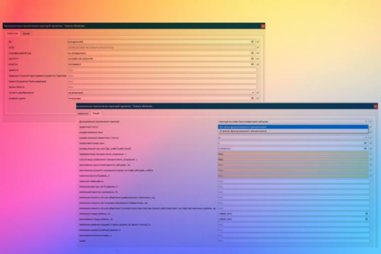
b) Forms for classes have been configured, including taking into account the rules for limiting the integrity of data for attributes defined by the approved requirements for the database.

c) A library of wildcards has been developed and the rules for displaying wildcards for each class have been configured.

d) The settings of the class styles were tested and the corresponding settings were saved to the database.

The last task of the first stage was the implementation of relations between classes. She became the only one that was transferred to the second stage of development due to the fact that during the work many questions arose regarding the logic of the work of these relations, laid down by the developers. In search of an answer to this question, the members of the initiative group not only discussed among themselves, but also turned to third-party database specialists. However, the participants never came to a unified vision, so the implementation was postponed to the second stage of the project.
In the process of working on the implementation of the GDB, various questions arose: technical, regarding the implementation of the approved structure by means of software; normative – to the requirements of the database structure approved by the order; and practical – regarding the application of GDB in the daily activities of its direct users. Most of these issues were resolved during the discussions, but those to which the participants did not find answers (for example, the above-mentioned issue of relations) were formulated in an open letter to the Ministry of Regions. You can read the letter at https://juliesdata.com/gdb_letter. The questions presented in the letter are divided into three groups. In the first, probable technical errors identified in the requirements for the GDB structure (for example, two attributes with the same name within the same class) are outlined. In the second part, the proposals of the participants on supplementing the structure of the GDB from the point of view of its practical application, based on the experience of the participants themselves, are presented. And in the third, a request was made to clarify certain provisions and requirements of the approved order regarding the structure of the GDB – such as the question of the logic of relations, which was laid down by the developers. At the moment, the letter has been sent to the Ministry of Regions and we are waiting for an official response.
Results of the first stage of the project
On October 19, 2022, at the open webinar “Free tools for the development of urban planning documentation. The presentation of the first stage” presented the current work of the initiative group, as well as announced their distribution under the terms of the Creative Commons Attribution-ShareAlike 4.0 license (CC BY-SA).
At the webinar, the participants of the crowdsourcing initiative considered two issues related to its implementation – the project itself and the context of its existence.
Julia Maksimova – project organizer, co-founder of the Julies Data consulting group, Ph.D., spoke in detail about its origin and organization, problems that arose during development and how the participants solved them, the results obtained and future actions of the developers.
Bohdana Stoyan – GAP “PRO ZEM” LLC, architect of the Ivano-Frankivsk branch of the SE UDNDIPM “Dipromisto” named after Yu. M. Bilokonya, spoke about her experience in the project, showed the work on spatial planning, which she creates with the help of developed tools. It was interesting to listen to Bohdana’s thoughts on the obstacles in the professional activity of architects, which prompted her to take part in the project.

Serhiy Kurenya, head of the urban planning cadastre and monitoring department of the Chernihiv State Administration, as a project participant and representative of state administration bodies, shared his thoughts on the importance of the initiative for Ukraine and the role of quality geospatial data in the activities of communities.
Julie’s Data co-founder Oleksiy Boyko explained the reasons for creating the project and the socio-cultural environment in which such projects operate.
In order for the webinar participants to better understand the presented contest, the organizers invited Anita Grazer, a member of the QGIS steering committee, a researcher in the field of spatial data at the Austrian Institute of Technology.
Anita shared her experience of using open GIS and its role in local government in Austria.
Anita’s opinion was continued by Nadiya Babinska, co-founder of the OpenUp Ukraine community, an open data specialist, who shared her thoughts on the situation with open data in Ukraine and the prospects for its use during and after the war.

A video of the webinar is available on YouTube.

Access to the result
Anyone can freely and for free use the result of joint work – the tools for the development of urban planning documentation at the local level, earning from professional activities without unnecessary operating costs.
You can get access to the BGD template by leaving a request.
What’s next?
The initiative continues its life and development and we invite everyone who wants to join it. The closest minimum tasks that are set for implementation at the next stage are to implement the relationship between the classes of BGD, set up the verification of the implementation of topology rules, which are included in the requirements for BGD, as well as develop a minimum set of IPT functionality for effective work with complex community plans.

Gratitude
Any project is not possible without those who invest in it, develop it and breathe life into it. Therefore, we would like to emphasize the contribution of the most active participants of the initiative, who are representatives of different regions of Ukraine, different specializations and have different experience – which in combination gave an incredible result, which resulted not only in the developed IPT, but also in the professional growth of each participant of the initiative in the process of interaction between by myself

Thank you to everyone:
Yuliya Maksimova, candidate of technical sciences, assistant professor at geoinformatics and photogrammetry department of KNUBA, GIS specialist Julie’s Data consulting group, fb, Kyiv, organizer, manager, developer , tester;
Oleksiy Boyko, GIS specialist, co-founder at Julie’s Data, tel. +380443389370, Kyiv, organizer, developer, tester;
Stoyan Bohdana Bohdanivna, certified architect in the field of development of urban planning documentation, GAP LLC “PRO ZEM”, architect of the Ivano-Frankivsk branch of the SE UDNDIPM “Dipromisto” named after Yu. M. Bilokonya, fb, Ivano-Frankivsk, developer, tester, consultant;
Nadia Pilipaka, certified architect in the field of development of urban planning documentation, Rivne, developer, consultant;
Oksana Zinoviivna Pyasetska, certified architect in the field of development of urban planning documentation, Lviv, developer, tester;
Tetyana Bogdanivna Kizilova, GAP, head of the APM group of SE UDNDIPM “Dipromisto”, Ivano-Frankivsk branch, certified architect in the field of development of urban planning documentation, Ivano-Frankivsk, developer;
Iryna Tkachenko, Ph.D., Assoc. department of highways, geodesy, land management and rural buildings of the National University “Poltava Polytechnic named after Yury Kondratyuk” fb, phone +380664577287, Poltava, developer, tester;
Volodymyr Melnyk, chief project architect of “Khersonzemproekt” LLC, certified architect in the field of development of urban planning documentation, certified land surveying engineer, fb, Kherson, developer of conventional signs of the topographic base M 1:10000 – M 1:500, tester, consultant;
Artem Serhiyevich Sorokin, certified land surveying engineer, certified geodetic engineer, fb, Zaporizhzhia, developer;
Yurii Volodymyrovych Gandziuk, certified geodetic engineer, tel. +380680973596, +380504066205, Rivne, developer;
Olena Tzvil. Land management and cadastre specialist, design engineer (city planning), Fb, Chernihiv, developer, consultant;
Natalia Syrota, architect, fb, Poltava, developer, consultant;
Mykola Anatoliyovych Skoryk, deputy head of the Kyiv regional branch of the NGO “Association of Land Management Specialists of Ukraine”, certified land surveyor, fb, Bila Tserkva , Kyiv region, developer, consultant;
Oleksandr Tyurin, born department of topographic and geodetic surveys LLC “Institute of Effective Technologies – Geo”, specialist in GIS, Zaporizhzhia, developer, consultant;
Daryna Mykolaivna Mamchur, land manager, fb, Rivne, developer;
Kurenya Serhiy, deputy head of the Department of Town Planning and Architecture of the Chernihiv Regional State Administration – head of the town planning cadastre and monitoring department, Chernihiv, developer;
Olesya Mykolaivna Shevchyk, Deputy Head of the Department of Housing, Construction and Architecture – Chief Architect of the Kosiv City Council of the Kosiv District of the Ivano-Frankivsk Region, fb, Kosiv, developer, tester;
Zhuravel Bogdan, land surveyor specialist in the local government, Kozelshchyna village, Kremenchutsky district, Poltava region, consultant;
Yanchuk Vira Vasylivna, head of the Sector of NMZ TP and GIS of SE “UkrNDPItsivilbud”, Kyiv, consultant;
Oleksandr Yuriyovych Popovych, Head of the Complex Design Department, MCP “Vinnytsia Municipal Center of Urban Planning and Architecture”, Vinnytsia, fb.


