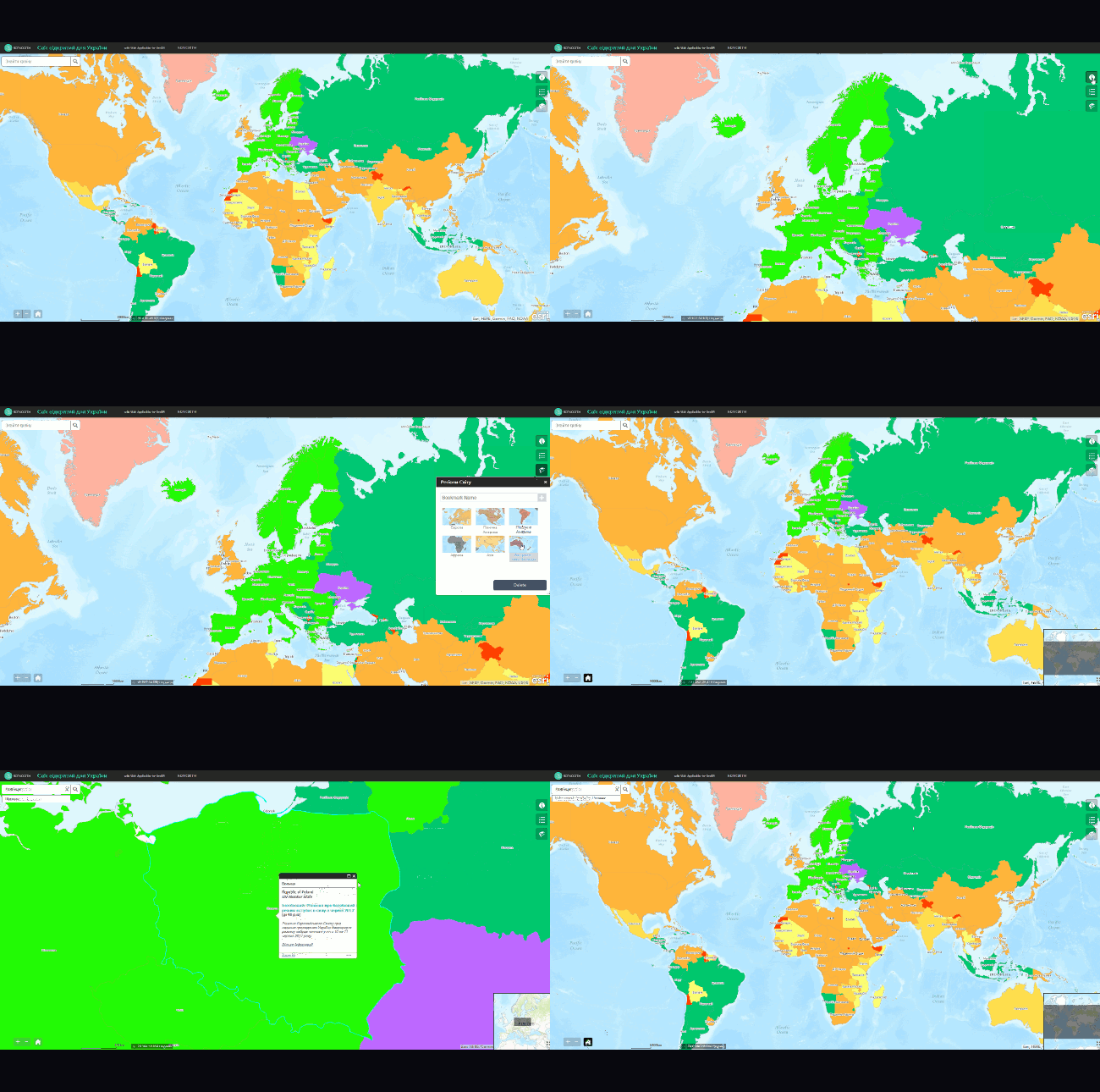
The world is becoming more open for the Ukrainians. On the 17th of May 2017, citizens of Ukraine have been granted visa-free travel in the EU, as the European Parliament gave final approval in Strasbourg, France. This decision will come into force on the night of June 10th, 2017. From then, the Ukrainians will be able […]
Mapping
Why take part in OpenStreenMap project? Andrey Golovin, one of the famous Ukrainian osmers, was trying to help us figure this out. You can read the first part of our conversation here. OpenStreet Map At the beginning, the users understand the map as a graphical representation on the website. And they begin to draw. […]
I am pleased that the post about cadastral map of Ukraine caused a lively interest of the community. So let me continue. Today there are at least 10 cadastres in Ukraine: State land cadastre State water cadastre State cadastre of animal life State cadastre of natural medicinal resources State cadastre of deposits and occurrences of […]
In February 2016, Secondary Cities project kicked off in Kharkiv, Ukraine. It is carried out by Humanitarian Information Unit of US State Department in collaboration with American Association of Geographers and Colorado State University. Secondary Cities project aims to “build partnerships to create geospatial capacity, enhance understanding through data and mapping and enable science-based decision […]
According to the UN, more than 54% of the global population lives in urban areas. Of course, the concept of “city” depending on a continent and a country. But regardless of the location all urban residents are united by their inclination to live in a safe, comfortable and attractive environment. Shaping of this environment relies […]
In early June this year Intellias company hosted the second “Map Solutions” conference in Kyiv. A brief overview can be found here. Today we will take a closer look at the speech of Vladimir Agafonkin, a well-known developer of the Leaflet library. Quoting his LinkedIn profile, Vladimir is a lead JavaScript Engineer at Mapbox, an […]
In this article you will learn: why cartography should change or die, how to create a map that is annoying, how to make an understandable map. Old-school Cartography In 2016, the word “cartography” often puts surprised look on the face of the person you’re talking to. Next, several questions may follow: aren’t all maps […]
I guess everyone has watched the Christmas special of ‘Sherlock’. (You haven’t? Well, you ought to: British TV-series are sometimes just brilliant.) Can you remember Sherlock sitting in the lotus position mentally scrolling through newspaper clippings? Now, do the same trick (but no googling, mind you!) to find a desired page from the classical book […]
Since ancient times, one of the map’s purposes has been land inventory. It is not surprising, because the land has always been the main wealth of most countries and the land tax served as a basis for the state treasury. Of course such an important business of tax collection demanded an information management system, this […]
UEFA Euro 2016 is in full swing – a true celebration for fans. A group round has just ended, and sadly, Ukraine’s national team quit fighting for Europe’s main football trophy. But the show goes on! Passions run high and beer flows, triumphs and sadness of defeat. France won its right to hold the European […]
- 2 of 4
- « Previous
- 1
- 2
- 3
- 4
- Next »