Минулого року я мала нагоду поспілкуватися з Андрієм Головіним. Він завзятий осмер, який присвятив мапінгу 1500 днів протягом 8 років, допоміг додати на карту, окрім іншого, місто-мільйонник Дніпро, зробив тисячі постів та правок на форумі та вікі ОСМ. Андрій розповів, як саме він став тим, ким є зараз.
Це цікава історія про працьовитість та цілеспрямованість, сподіваюся, що вам вона сподобається.
Я опинився на вулиці з одностороннім рухом і рухався не в тому напрямку
До того, як стати osmer-ом, я закінчив Дніпропетровський університет за спеціальністю «Фінанси та кредит», за фахом я економіст. Працював деякий час у банківській системі України, в різних банках.
Я вже точно не пам’ятаю, що це було, але мені треба було відвідати Харків. До того я там був лише один раз і цього разу вирішив їхати на авто, а щоб не заблукати у місті, вирішив взяти у друзів навігатор. І так трапилось, що я опинився на вулиці з одностороннім рухом, а я рухався не в тому напрямку, що треба. Мене спіткала вдача, і я не натрапив на ДАІ. Але коли їхав цією ж вулицею назад додому до Дніпропетровська, то побачив, як працівники ДАІ зупинили такого, мабуть, як і я, водія, що навмисне або випадково рухався не в тому напрямку. Коли я приїхав додому, вирішив, що треба якось на мапі виправити, або додати приміточку. Тоді це була навігаційна система iGO, я почав шукати оновлення, і як виявилось, у мене на той час була остання версія. Мені так і не вдалося виправити помилку на карті, і на якийсь час я про це забув.
OpenStreetMap
На той момент я цікавився Linux системами, періодично відвідував сайт linux.org.ua, на якому спільнота ділилась різними новинами, обговорювала питання щодо локалізації українською мовою застосунків для Linux систем. І одного разу, переглядаючи новини, я побачив анонс щодо OpenStreetMap.
Відкрив сайт, подивися власне місто, Дніпропетровськ (тепер вже Дніпро). Так, воно було на мапі, але були позначені лише основні шляхи. Ні будівель, ні базових вулиць, жодних вулиць на околицях міста не існувало. Я подивився, вирішив, що мапа, яку може правити кожен — це цікаво, і спробував. Додав кілька вулиць. Здається, нічого так. За кілька днів вони з’явились на мапі. Так час від часу заходив на цей сайт та додавав вулиці, використовуючи вбудований редактор, це був Potlatch першої версії, у якості фонових знімків були знімки від Yahoo.
В онлайн редакторі це було дуже незручно, він має обмежений функціонал. Я став шукати щось більш досконале. Виявилось, що на той час дуже активно розвивались два редактори: Merkaartor та JOSM. JOSM мав версію десь 1600–1700 (зараз поточна версія 10000+). Я спробував його запустити, але він не працював так, як слід, спробував Merkaartor, і все було добре. Але цей редактор був англійською мовою.

Джерело: OpenStreetMap Wiki
Створення мап — це лише частина справи
Як я з’ясував у процесі роботи з OSM, створення мап, тобто їх креслення — це лише частина справи. Інша частина — популяризація самого проекту. Але як його популяризувати серед місцевих користувачів? Треба було приймати рішення щодо мови. Я дізнався, що є дуже активний форум OSM, і почав відвідувати його, читати повідомлення. Найбільш активними спільнотами і досі є німецька та російська. На жаль, німецькою мовою я не володію, а от російською володію. От тоді і повстало питання локалізації сайту OSM та інструментів OSM, якими можна користуватись, а також довідки на вікі OSM. Я вирішив робити локалізацію українською мовою, розширювати україномовну спільноту OSM.
Тож вирішив робити переклади всього, що пов’язано з OSM, українською мовою. Перше — переклад редактора Merkaartor. Я повністю на той момент локалізував інтерфейс програми та надіслав патч з перекладом розробникам. У наступному релізі його додали. Потім я знайшов вихід, як можна локалізувати головну сторінку OSM, і почав перекладати її. Закінчив доволі швидко, виявилося, що я був не один, інші мапери допомагали.
Потроху JOSM розвивася, якісь негаразди були усунені, він запрацював, як належне, я почав ним користуватись.
І також стало питання з його локалізацією. На той момент загальна кількість рядків, яку було необхідно локалізувати, сягала приблизно 4000. Щоб мову було включено до пакунку, до складу основної програми, треба було перекласти не менше половини не менш ніж 2000 рядків. Тоді було перекладено декілька сотень рядків. Я почав перекладати, локалізовувати JOSM. Постало таке цікаве питання, що треба деякі терміни, поняття поєднувати, щоб вони виглядали однаково, як на сайті, так і у редакторі, поміж редакторами. Мала бути цілісність.
ГІС-освіта
Працюючи з перекладом JOSM, я стикнувся з тим, що деякі речі для мене не є зрозумілими, тобто термінологія і таке інше. Я сказав, що за фахом не був ГІС-спеціалістом, це був суто волонтерський мій порив приймати участь у проекті. Тому мені довелося звернутися до вікі OSM, де містяться тлумачення усіх понять, термінів, принципів роботи OSM. Англомовної вікі. Там існували переклади іншими мовами: німецькою, французькою, російською, польською… Частково і українською. Я почав також перекладати сторінки вікі українською мовою. По-перше, щоб самому розібратись, по-друге, допомогти іншим користувачам, що не володіють англійською, почати робити свій внесок у проект.
Я користувався Вікіпедією. Якщо там були статті, пов’язані з географією, я знаходив терміни там. Назви проекцій і тому подібне. Якщо там така інформація була відсутня, шукав через пошукові системи визначення термінів. Якщо траплялись скани підручників, намагався знайти визначення термінів, щоб зрозуміти, як це звучить, як переносити з англійської на українську.

Фото (с) Надія Ромашка, facebook
Синергія
Потім, коли така базова робота була виконана, почалась моя праця і над додаванням об’єктів на мапу. Також більш активно став перекладати статті, що описують основні загальні принципи роботи з мапою. Коли досвідчений користувач починає працювати, він вже має базу, від якої відштовхується. Якщо людина взагалі далека від ГІС і бачила мапу у школі у вигляді контурної карти під час фарбування — це зовсім інша річ. Тобто я на той момент був новачком, початківцем, який намагався розібратись, що до чого і якось робити свій внесок у проект.
Я працював на своїй основній посаді і OSM займався у вільний час.
На той час вже був не початківцем у використанні лінукс систем, і взагалі програмного забезпечення, що розповсюджується на вільних засадах.
Я знав, що треба бути не лише користувачем цих продуктів, але і повертати, робити свій внесок. Найліпший спосіб віддячити опен сорс системам — це брати участь у розвитку цих проектів. Якщо одна людина робить одну корисну річ, інша ще одну корисну річ, то разом вони роблять набагато більше, ніж кожен із них окремо.
Чому саме карти?
Я навіть не знаю, чому саме карти. Так зірки стали на небі. Скажімо так, коли я сідав і починав щось додавати на мапу, креслити будинки і вулиці, які були відсутні, це дозволяло мені якимось чином відпочити. Зміна роду заняття — це відпочинок. Я відчував, що я відпочиваю і роблю зі свого боку усе можливе, щоб сприяти розповсюдженню і поширенню вільних даних.
Для мене існує така ціль, як казав Річард Столмен, — інформація повинна розповсюджуватися вільно, без обмежень. Малювати карти виявилось для мене тим, що дуже непогано виходить, і таким чином я можу допомогти іншим людям скористатись цією інформацією, і зробити світ кращим.
Карти — це рушійна сила сучасного прогресу. Майже всю інформацію можна пов’язати з мапою. Додаючи на мапу різноманітні статистичні дані, можна отримувати наочну картину здоров’я суспільства. Наприклад, рівень злочинності, рівень бідності або достатку, постачання питної води, послуг — усе це можна відобразити на мапі.
Мапа — базовий інструмент, де можна відобразити, проаналізувати дані, спираючись на аналіз, приймати обґрунтовані рішення.
На поточний момент я займаюсь OSM вже сьомий рік, з 2009-го. І зараз робота з OSM стала моїм основним заняттям. Тобто я професійно займаюсь покращенням даних OSM, це є моєю основною роботою.

Статистика роботи Андрія на How did you contribute to OpenStreetMap? (18/01/2017)
Mapbox
У Mapbox працюють дуже талановиті люди. З ними працювати — це велика насолода. Можна дізнатись дуже багато цікавих речей. Так, працювати у Mapbox — мрія багатьох ГІС-спеціалістів. Компанія є дуже відкритою. Усі мають змогу, якщо є таке бажання, дізнатися, чим займаються інші. І всі діляться один з одним інформацією про досягнення, проекти, над якими працюють різні команди. Якщо виникають запитання, то команди тісно співпрацюють, допомагають подолати проблеми.
Ми кожного дня стикаємось з новими завданнями, які цікаво виконувати. Якщо раніше докладав основних зусиль до України, то зараз я працюю з даними по всьому світі. Таким чином, я можу дізнатися багато нового для себе і допомогти як людям по всьому світу, так і створити додану вартість продукту своєї компанії (каже економіст в мені). Я дуже пишаюсь тим, що я співпрацюю з такими людьми, як Володя Агафонкін, Том Макрайт (Tom MacWright), Ерік Гюндерсен (Eric Gundersen), Алекс Барт (Alex Barth), Арун Ганєш (Arun Ganesh), Рубен Мендоза (Ruben Mendoza) і багато інших по всьому світу. Це які докладають власних зусиль, досвіду, не цураються навчатись нового один від іншого.
OSM є джерелом базових даних, на які спирається наша компанія. Наша команда по роботі з даними, OSM data team, працює зі спільнотою OSM по всьому світі. Ми приймаємо дуже активну участь у роботі Humanitarian OpenStreetMap Team, HOT. Інженери Mapbox створюють інструменти, які є більшою частиною вільними і відкритими. Усі ці наробки кожен бажаючий може знайти на github у репозиторії Mapbox. Кожного дня ми отримуємо через форму зворотнього зв’язку повідомлення від користувачів щодо покращення даних OSM, виправлення помилок, які користувачі знаходять на мапах. Команда OSM data team виправляє ці помилки.
Дані для нас — найголовніше. Наша компанія кожного року робить грошовий внесок на підтримку серверів OSM. Mapbox є одним з важливих спонсорів проекту. Крім того представники компанії Mapbox приймають участь у конференціях, які пов’язані з відкритими даними, OSM. Також ми допомагаємо локальним спільнотам здійснити їх локальни проекти.

Фото (с) GIS-forum
Як розвиватися?
Треба приймати активну участь у спільному житті проекту, намагатись приймати участь у заходах, конференціях. Намагатись організовуватись з іншими учасниками, однодумцями. Не сидіти в своїй шкаралупі, а виходити назовні і контактувати з іншими людьми. Не тільки онлайн, а зустрічастися в житті, за чашечкою кави або кухлем пива.
OSM — це не тільки додавання даних, а це велика спільнота навколо цих даних. А також інструменти для роботи з даними і документація. Усе це потребує покращення. Наш світ швидкоплинний, все швидко змінюється. Підтримання даних в актуальному стані дуже важливо. І вимагає дуже багато зусиль. Не бійтеся брати ініціативу на себе.
Можу порадити навчатися, бути відкритим для нового, дослухатись порад інших. В колаборації, в співпраці один з одним досягається мета створення найкращої мапи в світі.
___________
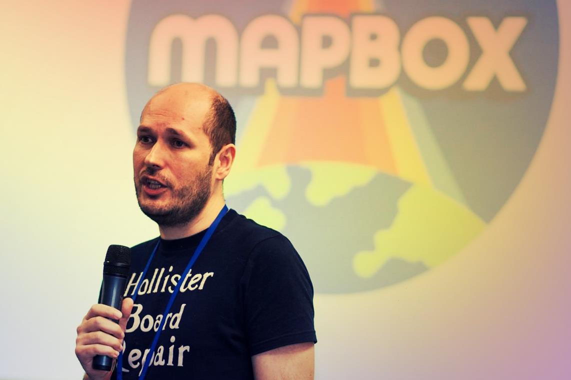
Заголовний знімок з конференції Map Solutions, джерело Intellias, facebook

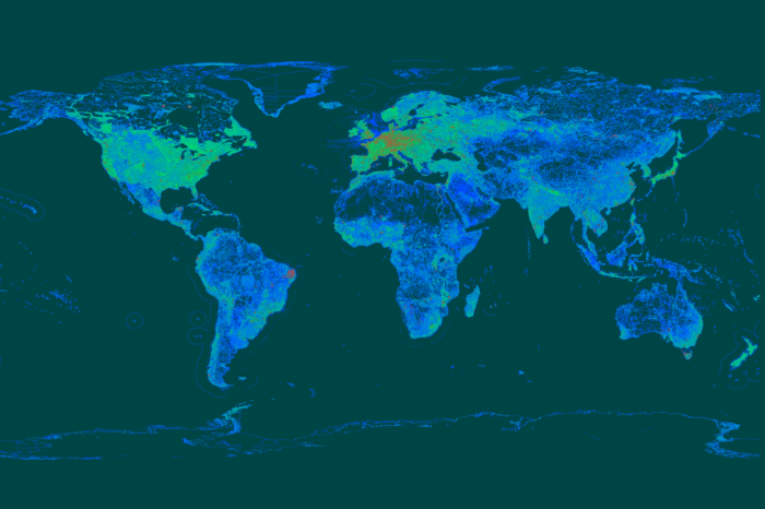
It is now more than 5.3 mln map changes: http://hdyc.neis-one.org/?andygol