tips-drones

The use of UAVs is spread in many areas of activity (we’ve talked about it in a previous post). Each of these areas requires specific approaches of drone preparation and operator training. Based on my own experience and the analysis of the experience of other specialists, I want to highlight the main aspects of the […]

Читати далі »

minimum-distance

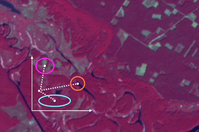
We have already posted a material about supervised classification algorithms, it was dedicated to parallelepiped algorithm. Now we are going to look at another popular one – minimum distance. In contrast with the parallelepiped classification, it is used when the class brightness values overlap in the spectral feature space (more details about choosing the right […]

Читати далі »

geodigest-6-17

Dates QGIS user conference, Hackfest, Developer meeting. August 2 -11. Registration is open. Maps and the Geospatial Revolution course is starting on  the 14th of August. Online ESRI cartography course November 1st – December 12 OSM Geography Awareness Week November 12-18. A list of State of the Map conferences across the globe.   Software ArcGIS […]

Читати далі »